The United States Map Project
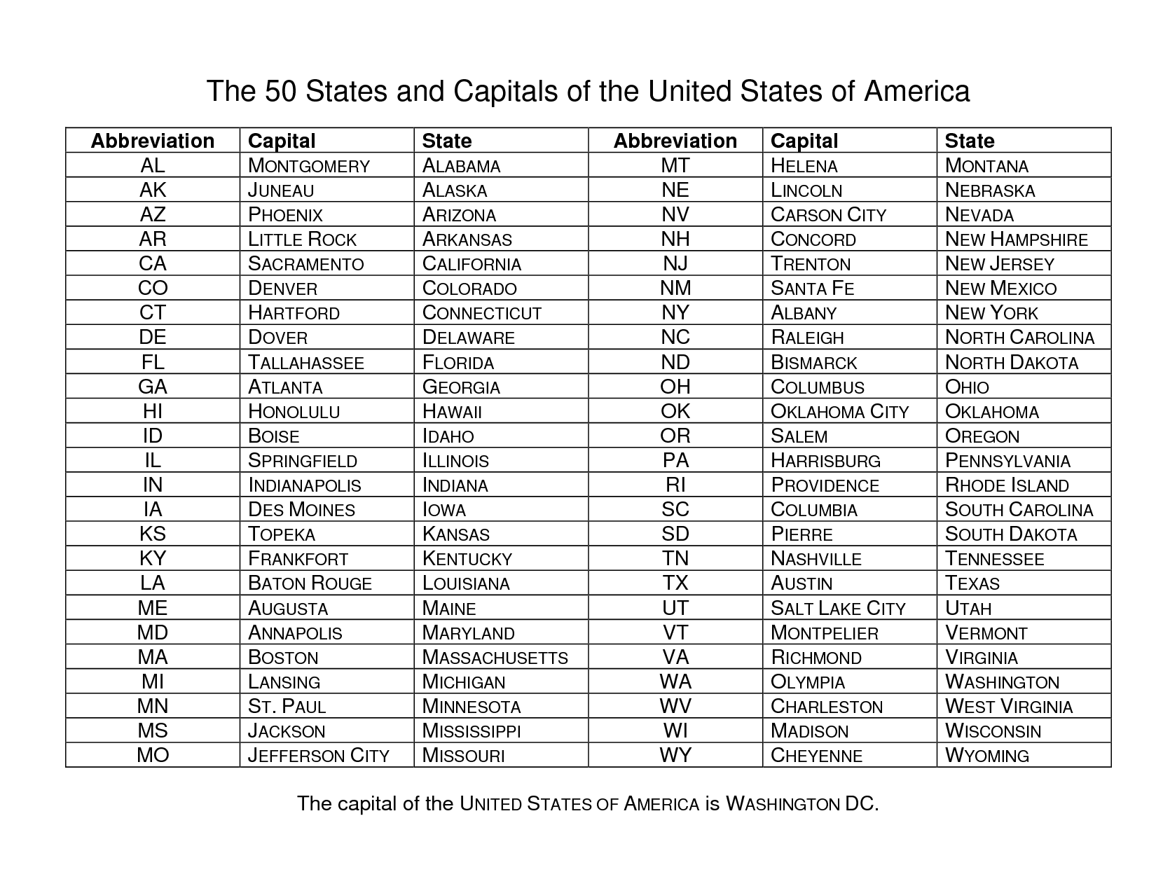
One of the goals for your Social Studies class is to learn the names, capitals, and locations of the 50 States. To help you learn these, we are going to be making our own maps of the United States divided into regions that make sense to you.
The Census divides the US into four regions: Northeast, Midwest, South, and West.
Census Divided Regions
We can divide the country into regions in many different ways. The NFL, for instance, divides the US into North, South, East, and West.
Your project (part 1):
Color code a map of the United States divided into regions of your choosing. Some ideas
- compass regions (northeast, southeast, north, northwest, southwest, etc)
- NFL regions (or MLB, NBA, or NHL)
- Population (see here for an example)
- Political parties (see here for an example)
- Climate (see here for an example)
Use this website to create your map.
Other resources for learning the states:
